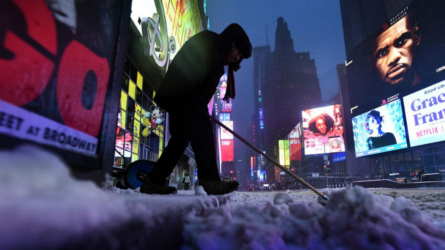
New York City is being hit by an East Coast “bomb cyclone” today. NYC public schools are closed, and the streets are already covered in snow. And if you step outside, you’ll feel the powerful winds that make 20-degree temperatures feel in the negatives (-10 at the highest tonight).
Here is the latest as issued Thursday morning by the National Weather Service (NWS) New York, New York:
Click the link for the latest on the ongoing winter storm, and the brutal cold to follow for Friday and Saturday.https://t.co/nPHsxyPVOw
The image shows the latest Winter Advisories and Warnings that are currently in effect. pic.twitter.com/1F4eHhsT4k
— NWS New York NY (@NWSNewYorkNY) January 4, 2018
The snow count has increased to 5 to 10 inches with a snowfall rate of 1 inch per hour. Winds are still expected to hit up to 45 mph, with the bulk of the storm tapering off by late afternoon/early evening.
Yesterday, Metro spoke to Meteorologist John Cristantello from NWS New York, New York, and he urged city-goers to stay inside if they don’t need to be on the roads.
Though he notes that we’ve seen snow like this before, “…all it takes is a little coating of it to create hazardous travel conditions.”
Hopefully you’re bundled up inside, away from the storm’s reach. And while you’re cooped up indoors, cup of coffee or hot tea in hand, you can watch as the “snow bomb” hits Times Square on USA TODAY’s Facebook page.
Snow! The #bombcyclone hits Times Square in NYC. Watch live on Facebook: https://t.co/A9BtRhHhd6
— USA TODAY (@USATODAY) January 4, 2018
Our busiest transit hub and commerical area already looks like a winter wonderland. You can watch the livestream here.
Stay warm!
For the latest updates on “bomb cyclone” winds, temperatures and snowfall, go to the NWS New York, New York twitter feed or the NWS Weather Forecast Office for NYC.

