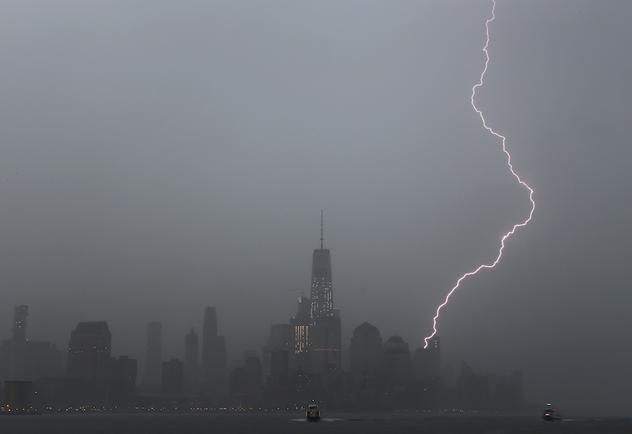
If you watched in raw wonder, mouth agape, on Saturday as an iron-clad vanguard of severe thunderstorms advanced on New York from the west, you were not alone.
Thunderstorms? Severe thunderstorms in February?
Though reduced to just heavy downpours once they reached the city and Long Island, this line was nearly as rambunctious crossing Pennsylvania, upstate New York and New Jersey as any of our midsummer’s strongest. While I couldn’t dig up the official average number of thunderstorm days in February for New York, I’ll offer that the number is near zero! But our climatological average for the whole year is about 25, and to have a scenario unfold as we did over the weekend is certainly extremely rare for late winter. So, what can we take from Saturday’s episode as we move forward into March this week?
For one, winter is most certainly on its last legs here. Look at the clash of air masses along this last cold front: tremendous, bizarre warming occurred ahead of it, a seasonable, cooler air mass settled in behind it. Warm air, with forcing from the cold front, provided the energy to build some of those thundercloud tops to over 40,000feet! That incredible warmup last week — many record highs were set on Friday and Saturday — has lingering effects that will last into spring! The total amount of heat that we receive, absorb, reflect, radiate, is called our “heat budget.” Having made a nice “deposit” into our annual heat “bank,” coupled with an ever-increasing sun angle, makes it tougher for cold invasions from the north to get a foothold here. Look at the cold air mass we’re in now: after a near freeze yesterday morning, how “cold” are we now? Warmer air is making a quick return as we ring in March, though it will be heralded by a warm front that’ll keep us under umbrellas for parts of the week before another cold invasion tries to overpower us Thursday. The week ahead:
Michael Friedmann, a New York-area meteorologist, can currently be seen on metropolitan area cable news on weekends. Follow him on Twitter at twitter.com/WeatherTalk.”
WeatherTalk: Thunderous February
Getty Images


